Posts

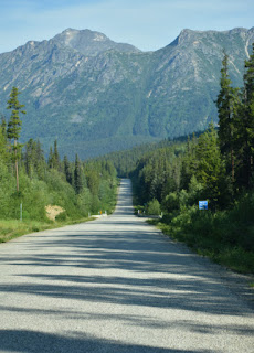
7/6/19 - Day 8 - The Klondike Highway

Image
Our first stop today was in Whitehorse, Yukon Territory. Most of those seeking their fortune during the Klondike gold rush of 1897-98 passed through this town  on their way to the gold fields surrounding Dawson City. This is one stop that Pat's grandfather, John Wood, and grandmother, Mary Mitchell, had to pass through as they separately worked their way to Dawson. Of course we took a few photos of Pat at the intersection of Wood and Main :-) Our next stop of the day was at the Montague Roadhouse. This site has the remains of the original buildings which would provide lodging and food for those going by stagecoach from Whitehorse to Dawson. We were surprised that the logs hadn't been peeled before building the structures... maybe they didn't have time?  You can still see the mud chinking in places between the logs. The last stop before making camp today was at the Tage Cho Hundan interpretive center at Carmacks. The girl working there was very informative and frien...

7/5/19 - Day 7 - Dust on the Trail and Hazy Sun

Image
We made it up to the Alcan today. It was a relatively uneventful drive from Deese Lake on the Cassiar Highway. We did see the rump of a large moose as it disappeared into the bushes and then later a grizzly ambling along in the ditch by the road. Compared to yesterday's animal sightings, it was a slow day. We traveled through a variety of forests again today and we covered over 300 miles. The skinny alpine spruce gave way to more arid pine forest. We passed through a large burned out area just south of where the Cassiar connects to the Alcan. There was also a section with a lodge pole pine forest. There were also many lakes and rivers. The Cassiar is a gorgeous road and could provide many different camping /fishing spots. These are the stages the jade goes through from rough stone to polished bear. Jade City was one stop today. It was interesting to see how they process the raw jade into the finished products. We bought a few pieces to see if we can work them into us...

7/4/19 - Day 6 - Moose, Lynx, and Bears, Oh My!

Image
After a drizzly evening we woke up to low clouds. So low that we couldn't even see the hill across from us, let alone the mountain with the waterfall behind that! However, after breaking camp we stopped in a turnout to watch for animals and drink our morning coffee. An hour later and the sun broke through the clouds. As we drove back down the valley, we were able to see the Bear Glacier Note the gushing water coming out of the left side of the terminus! again. This time though with the bright blue sky and sunshine, we could see they typical glacial blue color at the terminus and the crevasses.  This was such a gorgeous drive. Then we got back onto the Cassiar Highway which totally lived up to its reputation for wildlife viewing today! Not long after getting back onto Highway 37  I saw a black bear run off through a small grassy glade to our right. Then, maybe 15 minutes later, both of us saw a black bear standing on the right embankment looking at the road. About 15...

7/3/19 - Day 5 - Stewart-Hyder Highway

Image
We woke up to overcast skies and mid 60's as we travel north. Our goal today is to head up Highway 37A to Stewart, Canada & Hyder, USA. We were surprised that the town of Smithers is larger than New Hazelton. It looked like the reverse on our maps, however the gas at New Hazelton cost less, so that worked out ok.      There were a few stops on Highway 16 between Telkwa and our turn onto the Cassiar Highway, 37, which we'd like to visit on our return trip... or not, if we are like horses heading to the barn! We made a short stop just as you turn on to the Cassiar that was very interesting. The tiny village of Gitwangak (native spelling, Git-Gyeetsw) has some totem poles that date back to the 1800's, as one of the tribal members told us. In addition, there was an Anglican Church bell tower that was built in 1864. Each culture's  woodwork had its own kind of artistry. Not far up the Cassiar we saw a black bear on the side of the embankment. The dark b...

7/2/19 - Day 4 - Yellowhead Highway, Highway 16

Image
Another sunny morning! After a breakfast of cinnamon roll french toast, we were on our way again. Today's goal... drive further than we have been or we'll never even get to Alaska! At Prince George we headed west on the Yellowhead Highway, Hwy 16. It connects Prince Rupert on the west with Alberta. From that highway we will head north on the Cassiar Highway. One of the many little ponds or lakes along the way. This is a fairly flat highway and it reminded us of Minnesota: flat land, low trees, and many lakes. I suppose that is why they call part of this area the "Lakes Region".  We stopped in to check out  Beaumont Provincial Park just out of Vanderhoof. It was a great looking campground, large sites, separated from other sites, and it had a nice picnic-swimming beach. Maybe that will be a stop on our return trip. We ended up stopping for the day just past the little town of Telkwa. It is a tiny town, but has a cute walking path along the river. It was ni...

7/1/19 - Day 3 - Happy Canada Day

Image
We woke to sunny skies and ended Canada Day with this sunshine, however in between along the Caribou Highway there were some ugly black clouds and torrential rain showers that caused the automatic windshield wipers to go full speed (see the video below). One such downpour occurred when we were approaching William's Lake where we had planned to head to the town of Likely following the "Gold Rush Route"... hmmm, well, we re-thought our route and opted to continue north, we can go check out Likely on our return. That being the case, we put on more miles today and ended up just south of Prince George. The landscape has changed yet again. There are now a mix of pine and aspen trees, along with light underbrush. The RV park we're at has a lot of aspen and the slightest breeze has the leaves rustling. Aspen Quiv'ring leaves rustle Slight breezes set them dancing Music fills the air Speaking of RV parks, we  were surprised today to find that between Cach...

6/30/19 - Day 2 - Sea to Sky Highway

Image
We were pleasantly surprised this morning to wake up to blue sky. We could see some of the peaks toward the west which we didn't suspect were there due to yesterday's clouds. After leaving camp, we backtracked a kilometer to take a quick stroll  to see Shannon Falls (third largest falls in Canada). Wow, crowded already at 9AM! Many different languages were heard amongst the other travelers. Back on the Sea to Sky Highway, our goal for the day... get over the pass and to Cache Creek. This was definitely a scenic drive although crazy busy in the Whistler area, and further on, the Geoffy Lake area. Most of the road is a winding two lane mountain road. Very few passing lanes, periodic turnouts, and gorgeous views around every corner. There were a number of places that had 13% road grade (that's pretty steep) and 20 kmh hairpin corners (that's 12 mph, for non-metric folks). It was a great test for our truck. The truck's exhaust brake was really great for the steep g...